#14 Bois Brule River, Wisconsin / Return

Ready to roll

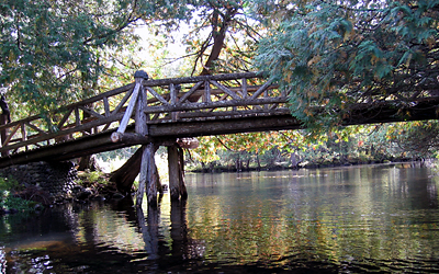
May 15, 2004—Most of the rivers that I have paddled would be called “flat water” rivers. Once I had mentioned that I would like to learn how to be more comfortable in the face of rocky turns, unexpected sweepers, and quick water — that I would like to learn to enjoy a lush rock garden instead of dreading it!

Well, be careful what you ask for! My family gave me a two day Whitewater Training session with the Wild Institute (thewildinstitute​.com) for Christmas! My heart sank when I opened the envelope — the certificate promised two days on a northern Wisconsin River in the middle of May. The ice would barely be off the river! My fourth generation Florida blood was already shaking at the thought.

14-Canoe trailer
Canoe trailer

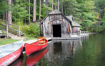
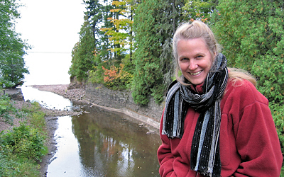
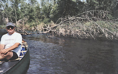
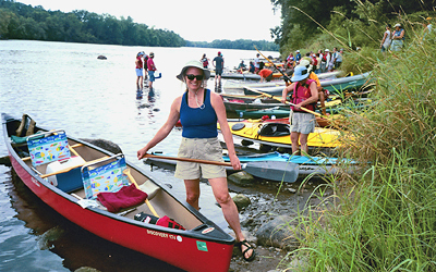
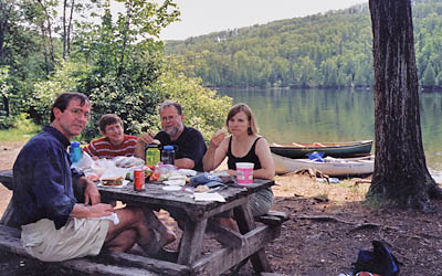
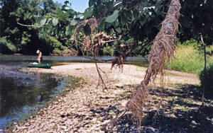
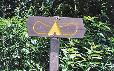
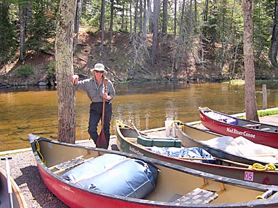
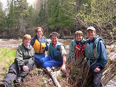
May did finally arrive and even though the weather promised to be below freezing for the first night of camping, I drove north to find the DNR campground beside the beautiful Bois Brule (see river #14). I found the group and we set up our tents as a small village, all  circled around the cook’s table. The Wild Institute is an organization led by Chris Heeter, a tall, clear-eyed woman who teaches women to manage rivers in the summers and to run dog sleds in the winter. I joined several other students and the weekend began with a fish dinner followed by a warm fire. That night the temperature dropped to 25 degrees and by morning I had layered every single piece of clothing I had brought along, including my deep winter down coat. Were we really going to go out on the water in this?

Chris Heeter Instructs
Chris Heeter instructs

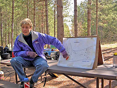
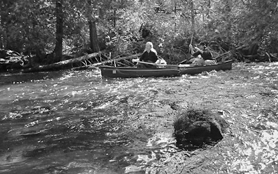
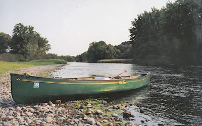
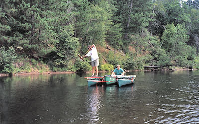
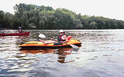
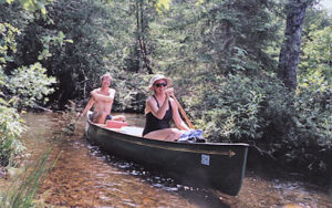
Bundled up in our winter gear we sat in a circle as Chris and Marti gave us ground school lessons. Draw strokes, cross draw strokes, ferrying, and eddying out were all outlined and demonstrated. After the lecture we headed to the water where carrying the six canoes and gear helped warm us all up. The sky cleared a little and a weak sun was gratefully praised. I even peeled off my wet suit and by the time we set off I thought that we could manage this as long as we were on top of the water, not in it.

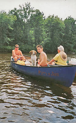
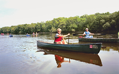
We spent the entire day navigating the river, learning the bow stokes that help steer a canoe in quick water. We all successfully accomplished the rapids at Little

Ready to roll
Ready to roll

Joe (the same rapids I had held my breath on during our first navigation of the river.) It was thrilling to feel a growing confidence. That night we ate a tremendous meal by the fire and turned in early. The next day a steady rain  welcomed us but by now I knew that the Wild Institute does not consider inclement weather to be a deterrent to paddling. This time we headed north to a more active, rocky part of the river and ground school instruction had to be delivered loudly over the churning water and the falling rain.

White water
White water

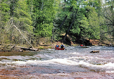
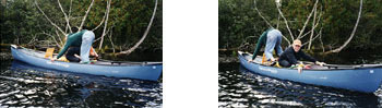
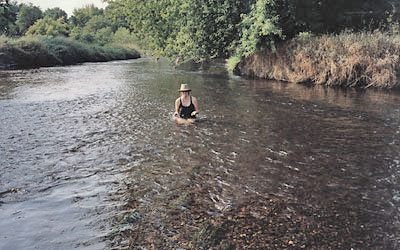
We students were to take on the stern paddling position (steering from the back) today. Chris demonstrated the right and left paddle responses, and eddying directions from the back. Everything was suddenly switched. We entered the water and somehow the stress of the rapid new information, the fast water peppered with rocks, and my own dyslexia confused me so much that a mild panic overtook me. Suddenly left was right and right was left and I could not remember ANYTHING I had just learned. With great patience the instructors helped me get a grip on things and we practiced over and over until I could understand what stroke would move the canoe in each direction. This was a revelatory moment for me — I live in a world where I am competent at most things I do, and suddenly I was incapable of the simplest direction, but the river’s relentless rushing said: you must act NOW! Patience, slowing down, repetition, kindness around me — all these steps helped me prepare for the coming “Ledges,” a series of Class II drops that were going to test our newly acquired skills later in the afternoon.

Masterful paddle
Masterful paddle

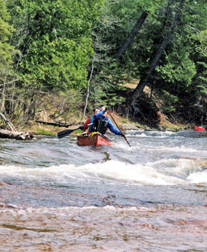
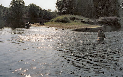
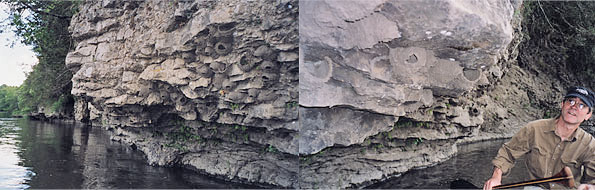
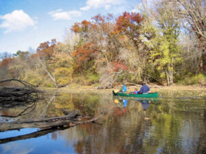
As a group we all walked the banks of the Ledges, scouting the drops, listening intently to our instructors describe the through lines we hoped to paddle for each churning ledge. It was scary to look at — I did not think I could manage it, but I did not see how I could get out of it. I was resigned: I’ll just do the best I can.


Success!
Success!

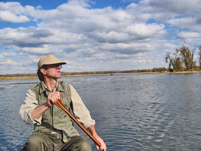
I am happy to report that my canoeing partner, Sherry, and I  made it over the drops with some grace. It all happened very fast, and my body reacted quickly enough to work with my excellent stern paddler. Throughout all this I watched Chris manage a solo canoe down the same rushing rapids, slowly, carefully, picking her entrances and exits, working the churning water to her speed instead of vice versa. It was an inspiration to watch and enough to make me say…Maybe I’ll learn that, next…

#13 The Sloughs of the Mississippi River

Wind on the Lake
Trempealeau Hotel
Trempealeau Hotel

(Note: We have decided to count the Mississippi River, one of the world’s greatest rivers, as many times as we can find a way to journey on part of it!)

On Saturday, October 25th, we gathered for lunch at the old Trempealeau Hotel in Trempealeau, Wisconsin. The hotel was opened in 1871 and sits a stone’s throw from the Mississippi River, the railroad, and Lock and Dam #6. People, trains, and barges are constantly moving past the windows of the hotel and it is not hard to imagine the French trappers who settled the area striding up to the original bar and ordering a stout drink. The town is nestled at the foot of surprising mountains — surprising for the Midwest! — and on this particular Saturday the hills were covered in golden leaves, all about to leave their branches in the first high wind. We could not believe our luck! One more gorgeous paddle before winter closed the waters…

Ben and Jake
Ben and Jake

Ian and I were joined by Jerry and Ben, (see Minnehaha Creek and Bridal Veil Falls), and Ben’s friend, Jake. We launched our twin Old Town Penobscot canoes and paddled off under a sky so blue it seemed a cartoon artist had painted it above us. This time we planned to follow a “canoe trail” that Jerry had researched. Not far into the narrow channel we found the first of the blue diamond signs and turned off to the slough. (A slough, pronounced “slew” or “slouw,” depending where you grow up, is a swamp-like land bordering a river.) The slough was narrow and twisting, and draped with trees. Every small breeze released a rain of golden leaves. The small blue trail signs were not always easy to find and the water twisted and turned, so each spotting of a blue diamond was a great comfort.


Turtle Shell
Turtle Shell

We heard animals, but saw only a hawk and a glimpse of a bald eagle, until a golden retriever came bounding out of the woods. Hunting season. Time to be careful. Suddenly the water grew thin and abruptly ran out all together. We were stuck in thick black mud. We had to drag ourselves across the muck to what was once river bottom but was now a dry sandbar filling the river bed.

Open river
Open river

Ian set off to scout the situation while we lugged our snacks to the driftwood log in the middle of the sandy stretch. Ian returned with a turtle shell and news that the river started again in the big Mississippi, and then turned inland up ahead. Should we continue in such low water conditions, or turn around while we could still float our way back to start? We ate. We drank. We discussed. We voted, and decided to head on and hope the water grew.

Wind on the Lake
Wind on the Lake

After twists and turns with plenty of water the path suddenly opened up and we found ourselves on the edge of a huge shallow lake. Tall reeds grew everywhere  and we set off across, not exactly certain where the trail actually directed us. No sooner had we entered the lake when a fierce wind swept up. We paddled with all our strength and went nowhere. Finally we headed toward the shoreline where the wind was cut by the straggly reeds but the water was too shallow. Back out in the wind we struggled. Ian’s hat blew across the water but Ben fished it out right before it sunk. Ian and I pulled ahead and found the very comforting blue diamond sign at the entrance to another narrow cut of water. The wind died as soon as we entered the protected channel and we pulled ashore to catch our breath and wait for our fellow travelers. We waited. And waited. Finally we heard them, SINGING at the top of their lungs. “He’s got big fat trees in his hands…” They were making up crazy verses to He’s Got the Whole World in His Hands and Ben swears they would not have made it through the wicked wind without the song. (Most of the verses I cannot repeat!)

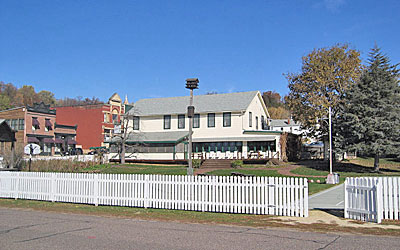
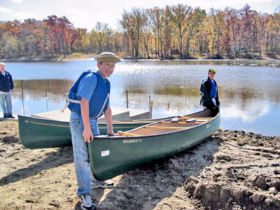
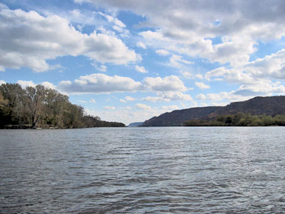
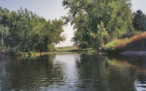
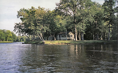
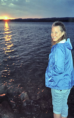
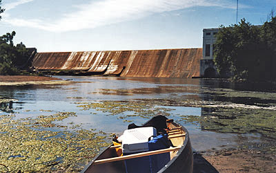
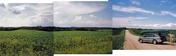
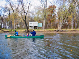
On the last stretch we paddled past more of the odd houses bordering the edge of the slough. Every cabin was perched on top of six to eight foot pilings, safe from the wrath of a rising Mississippi. The wind was chilly when we pulled into the boat slip. We were covered with mud and getting cold as we tied the boats to the car racks. Homer writes of “the rosy fingered dawn” but as we turned out on the road we found the northern sky filled with “black-clawed winter.” Like the arching reach of Mordor, we could actually see winter coming for us with its dark, cold sky. The day that began in gold edged blue ended in shivering black. But somehow we had slipped our canoes through the very last hours of fall and we were nothing but gloriously happy and tired.


#12 Vermillion River, Minnesota

vermillion_1_400
Golden air

Trouble finding the put-in and take-out had us making sandwiches late in the day while pondering the shining small stream. We ate and watched it curve under a canopy of golden leaves on the most gorgeous of Indian summer days. We shoved off with our map in hand and immediately found our strokes scraping sand. We hoped it would deepen soon.

The meandering Vermillion is a river with a split personality. Behind us this same thin water had just plunged 100 gushing feet through Old Mill Park and the falls of Hastings, Minnesota, crashing over rocks as it rushed through a high and narrow gorge. It was hard to believe that this was the same water now lazily skimming the sandy bottom.

Fish roiling below!
Fish roiling below!

But this river had many surprises in store for us-For the first time we found ourselves on water with twists and turns and branching choices. Oddly, our usually reliable river map showed no branches, and no answers. Should we go right? Left? Again and again we would study the leaves floating on the river’s surface and try to sense which way the current flowed the strongest.

Our first branching choice took us to a large lake. The lake water thinned yet again and when I swung my leg out of the boat to walk the canoe I was sucked into a quicksand of black mud, trapped up to my thigh. Pulling with all my might, I tumbled back in the canoe.

Mucky shallows
Mucky shallows

 Covered with mud I looked up just in time to see the largest bird I’ve ever seen, circling. It dwarfed the other huge predators that shared the sky. Just ahead downed tree stumps made a bony fence across our path and we picked our way through them in eerie silence. A huge fish splashed, breaking the quiet, and rattling us. Soon the fish grew so thick that when Ian and I dipped our paddles we were often startled to feel not water but the quick muscular throb of one of these river giants. No wonder the biggest bird in the world was circling overhead. We made it to the end of the lake only to find a mass of still leaves covering the stagnant surface of the water. There was no outlet. We had no choice but to go back to the faraway branch in the river where we had guessed “turn right.”

On the trip back the water shrank again and we had to walk, pulling the canoe by a strap, paddling against the current when the water was deep enough. Finally we returned to our mistake. But not twenty yards down the left hand branch, the stream was blocked by a huge tangle of fallen tree trunks.

Out of water
Out of water

 We hauled the canoe over the knobby marsh beside the blocked stream and set off again. A hunter’s gun shots rang out nearby. When quiet returned we talked about how odd the lake had been-the sucking mud and startling fish, the huge circling birds and bony tree trunks. We could not help but call it a lake in Mirkwood, the frightening forest of Tolkein’s, The Fellowship of the Ring. (We had listened to part of this tale on the drive down.)


Thin water
Thin water

The Vermillion was beautiful but rigorous. Late fall and a summer of drought had made the water so shallow that we estimated that half of our paddle strokes touched sand. Beavers had been busy blockading the narrow turns. Signs of flooding told the story of the hundreds of riverbank trees now toppled into the river. We portaged one huge blockade, and hauled the canoe over another dam of logs. We walked when we had to, and often slipped under logs so tightly we had to lay down in the canoe to clear the passage. Once we threaded our way through a submerged log obstacle course so slowly that it was as if we were paddling on tip-toe.

Beaver evidence
Beaver evidence

 On an open piece of water a bald eagle swooped down for a fish, suddenly pulling out of its dive and rising right in front of us, giant golden talons still exposed.

By now we were losing the river light to the sinking sun. This was not a river to be on in darkness. Nervously we looked for the take out bridge at every bend. We had paddled so long that we figured we were on the wrong river, not the one on our map. Were we lost on some slough that edged the river further south? Finally, with only minutes of light left, we turned sharply onto a wide and open section of river. A boat landing shined just ahead and we decided to end the trip early, hide the canoe, and head to our car by road.


Even thinner water
Even thinner water

A kind man gave us a lift to the bridge where we had left our car. After he roared off we realized that we had left the keys to Ian’s car in my car, way back at the put-in. Phil, another kind stranger, gave us a ride the many miles back to our car – He was a knight-in-shining-armor to me, welcoming us calmly though we were lugging paddles and covered with mud. Finally we picked up my car, drove to our hidden canoe and loaded it under an orange harvest moon. We drove south to Ian’s Trooper, key in hand, this time.

As we followed each other home I listened to Frodo fight off the Black Riders. Their trials made me think – some days things go wrong. Some days lots of things can go wrong..

Hawk watches us
Hawk watches us

 Paddling with someone is a constant give-and-take and somehow we had (mostly) kept our good cheer through all the things that went awry. Later Ian and I made a pact: We want to stay open to everything that happens, ready for it all, not blaming ever, and never losing sight of the beauty. We need each other’s help to accomplish more than we ever could alone. Frodo and his company would agree, I think, don’t you?

#11 Bois Brule, Brule, Wisconsin

Boat house
Debra
Debra

I promised myself that when I finished the pictures for The Incredible Water Show I would head to the Bois Brule River. Immediately after driving the boxed pictures to Fed‑X (for the second time) I headed north, meeting Amy, Steve, and Ian in the tiny town of Brule, Wisconsin. Rain was predicted for the next day but we decided to prepare for any weather and stick to our plan. Early the next morning we ate breakfast under gray skies and crossed the street to the Brule River Outfitter who would shuttle us (with canoes) down to Stone’s Bridge for the start of our sixteen mile paddle.

The Bois Brule River basin was created as the last ice sheet retreated. The rushing southern flowing meltwater carved the river’s valley but eventually the meltwater tapered off. These shallower waters met the ridge between the St. Croix and the Bois Brule and were forced to slide back, finally reversing the water’s course. Today the Bois Brule drains out of the bog created from those early meltwaters, and still empties into Lake Superior.

On this Friday morning the rain hung heavy in clouds. It stormed to our right and our left, but not a drop fell on us. We set out between the pine and cedars hugging the narrow river and paddling around our first bend we were Fall-Struck by a tree turned brilliant gold. The water was so still that every leaf shined twice, once on the tree and once on the river. Steve turned out to be a very good paddler and one of his tricks was a mid-water exchange. It is best explained by pictures.

 
Mid-water exchange
Mid-water exchange

Much of the river runs through the Brule State Forest but a long section in the middle is privately owned.

Cedar Island Estate Bridge

 This section includes Cedar Island Estates, a group of log and cedar lodges and cabins built on 4,000 acres. Five presidents have visited this river to fish, (the only river to claim so many presidential visits), three of them staying at Cedar Island, and all of them probably crossing this old foot bridge linking the homes. (The Presidents include: Grant, Cleveland, Coolidge, Hoover, and Eisenhower.)

Most of the upper Midwest was logged in the 1800’s, and some areas have been logged yet again. Along the Bois Brule an occasional old growth pine had, for some unexplainable reason, been left standing. The sight of our first magnificent, giant tree took our breath away – it was royal, magical, towering, and strong. My awe was so great that I forgot to reach for my camera before we floated past.

Class II rapid
Class II rapid

 After the majestic old tree we came upon a short Class II rapids. I would have portaged the rushing water but Steve said we could do it easily. We beached the canoes and walked the rapids, planning our route. Our traveling companions went first and Ian and I followed. Steve took this Black & White picture just as we sailed into safety, dry and happy!


Shire picnic
Shire picnic

We lunched next to a tumbled down picnic shelter. The sun came out to join us, and the tiny grove of trees looked like a scene from the Shire in Bilbo’s day. (Ian and I listened to the The Fellowship of the Ring (by Tolkein) on tape as we drove to our rendezvous.)

Boat house
Boat house


Later the river widened into two long thin lakes and twisted past huge log homes that often had boathouses floating on the river. This one had only red canoes and inside that dark door hung a long row of carefully stored red-handled paddles. The sun joined us again and the banks lit up with color, setting the river on fire.

The next stretch of river was peppered with rocks that had to be dodged and the canoe rocked many times. Please remember that I am a fourth generation Floridian. There is nothing a Florida native hates more than the thought of a cold water spill so when the roar and tug of Little Joe Falls reached us, I was ready to portage.

Just short of the falls we beached the canoes and walked the steep, slippery scouting trail. It was clear that it would be impossible to carry the 17 foot Lunar Eclipse over this path. We studied the rocks and discussed a route through the rapids: Enter center, then veer sharply right, watch the boulder at the bottom. Back at the beach we secured everything to the canoe, and checked that all cameras were double bagged. I stripped down to a single layer so I’d have plenty of dry clothing should we tumble in the cold water. I was certain we would soon be wet.

Brule Fall leaves
Brule Fall leaves

Amy and Steve went first. We could not see them but we heard their victorious cry. They’d made it! Far above we pulled off shore and sculled at the top of the rapids. Amy signaled the path to the right and we shoved off. The river caught us and I barely remember anything but white froth and wet rocks shooting past, then the huge boulder suddenly popping up right in front of our canoe. I made a quick draw stroke and Ian steered hard from the stern. We flew by. When we joined our partners below the falls I realized I wasn’t WET! I went ashore to dress warmly again and we were off to paddle the last few miles of what Ian called his “favorite river, yet.”

#10 Red Cedar River, Wisconsin

Jim paddles
Cedar River
Cedar River

Jim and I set off for our first paddle together on Wisconsin’s Red Cedar River. We couldn’t find the put-in on our map and had to find a new starting place, adding an extra four miles to the trip. Our late departure worried me. Could we paddle the fifteen miles before dark? We then shuttled our own cars back and forth three times before eating a quick lunch and shoving off into the clear river.

I sat in the stern (back) and was able to practice my steering, which required immediate attention as we headed down a small Class I rapids within a minute of setting out. But quickly the water began working its magic. I was calmed by the pace of steady paddling and the slow way the world unfolds from a canoe. The Red Cedar River runs through farmland and often the arching rows of corn ran right down to the river, and the occasional cow chewed and watched us paddle by. The river was shallow. Long lengths of bright green grasses grew in thick clumps, brushing the surface like watery hair. A snapping turtle dived next to our canoe and swam like mad before peeling away to the shore.

Jim paddles
Jim paddles

A huge bald eagle surprised us by swooping down across the narrow river. He surprised us even more by accompanying us nearly the entire afternoon, flying off high branches as we approached, sailing down the middle of the river and disappearing again. Once Jim said, “Where’s my eagle?” and just then he appeared above us, quiet, watching from a branch.

Early in the trip we came to a “strainer,” which is a downed tree that lies across the water. This strainer had plenty of unobstructed river to the right, but nonetheless, a downed tree always make me a bit nervous since our Rice Creek paddle. (River #1) That day the creek’s rushing high spring water sent us crashing into a dozen dangerous strainers. I felt the grip of those claws once when my life jacket was caught by a stiff branch and the current was too stiff to resist. But today’s shallow river flowed with the gentle current of late summer and we slipped by without a scratch.

We paddled on through the clear water and the green grasses and then suddenly, everything changed.

Cedar River, WI
Cedar River, WI

 The bottom of the river turned black. The flowing grasses were only stubs of bare stems. Dark algae grew on everything. No fish. No turtles. It was like seeing Isengaard after it was burned in Tolkein’s Two Towers. The devastation was probably due to agricultural runoff of chemicals and the river had suffocated. We paddled another mile before the healthy bottom began to return. It was shocking to see the difference between a living stretch of river and a dead one. The day was hot and we stopped on a tiny island’s rocky point to rest. The water was too shallow for swimming so I sat in the rushing current and tried to find a rock to match the perfect egg shaped rock that Jim had found. (no luck).

Cedar Swim
Cedar Swim

Our eagle had one more surprise visit in store for us – We spotted him high above and slowly paddled toward his perch. He let us get closer and closer until we glided right under him, so close we could see his huge golden claws gripping the bark. The day was darkening and we still had a couple of miles to go so when a double strainer loomed out from both banks we decided to take the shallow route around the tiny island, avoiding the strainers altogether. We had paddled only about twenty yards when a huge beaver dam blocked our path.

Cedar swim 2
Cedar swim 2

We paddled back to the main river where we paused on the muddy shore to assess our situation. We had to cross the current to a tiny inlet on the other side and then shoot back through the narrow opening perfectly or fall into those claws.

We were careful and our aim was perfect. We sailed through the narrow break in the trees and found our takeout just as dusk settled on the river.

#8 & 9 Namekagon and the St. Croix Rivers, WI and MN

Jack's Cabin Rentals
Jack’s Cabin Rentals

Ian and I set off to find Jack’s Canoe Rental hidden somewhere beside the Namekagon River in Wisconsin. Jack himself had promised to shuttle us from put-in to take-out and back again. We found this tiny cabin serving as his office. It was surrounded by dozens of canoes and a line of people waiting to be shuttled to various points on this well-known canoeing river.

It was a hot and humid Sunday and the river was quiet with animals but lively with people. Once again the humans were as interesting as any wild creatures. Our first surprise came at the put-in where I waited for Ian’s return.

Crazy craft
Crazy craft

I met a pair of men who had spent Saturday evening building their one-of-a-kind pontoon boat and had hauled it to the river for its first voyage. They had built a platform over two kayaks with a canoe in-between. The craft could be steered by the canoeing bowsman, as well as poled by the other passenger on deck. They had spray painted the platform a rough camouflage green. They spent well over an hour on shore imagining how it might perform, and naming it. They decided on: The Green Party Platform. They set off and disappeared around a curve in the river and all was quiet once again. Hours later we found them alive and well, shooting fish with a cross bow. At our passing the fish were still winning.

The Namekagon starts in northern Wisconsin and winds its way to the St. Croix River.

Dog in canoe
Dog in canoe

The St. Croix serves as a border to Minnesota and Wisconsin and both rivers are protected by the Wild and Scenic Rivers Act, (1968), a visionary piece of legislation that protected 8 rivers in the United States from development. The early part of our trip found us paddling between sandy banks and spiky pines. The heat hushed the shoreline and the lack of bird song was eerie. The water was startling clear, shallow in patches, and filled with schools of fish. Throughout the day we crossed paths with a three-canoe family who was traveling with Sierra, a perky beagle. At one crossing I saw him perched upon the thwart (wooden cross piece) and the gunnel (side), nose up, a fine river-worthy dog!

We made a rest stop at the end of a series of Class I rapids. An osprey dived for a fish in the riffles and suddenly stopped mid-air, soaring away.

Moth on finger
Moth on finger

 A tiny butterfly took a liking to my finger and returned again and again. Throughout the afternoon the river gradually changed from pine to hardwoods as the slow gradient took us toward the confluence of the St. Croix. House sightings were very rare but when we rounded the bend where the waters from the two rivers met, this tiny cabin sat watching those two rivers blend their waters.

We headed south, downstream, along the St. Croix and as the afternoon sun set we

St. Croix River
St. Croix River

passed a swamped canoe (they needed no help they said, though it was their fifth dump of the day!), a flock of ducks basking on the rocks, and a huge log held prisoner high and dry on a rock. It had been left behind months ago by spring’s high waters. I wonder when the river will rise enough to free it and send it floating off to the St. Croix, then to the Mississippi, or maybe all the way to the salty Gulf of Mexico?

#7 Mississippi River, Minnesota

Friends of the Mississippi

At the last minute Ian and I moved from the waiting list to a spot on the Friends of the Mississippi’s group paddle down a twelve mile stretch just north of the Twin Cities of Minneapolis and St. Paul, Minnesota. Early Sunday morning we joined fifty-three other paddlers at a roadside park in Elk River where we dropped our canoes and supplies. We drove to Anoka where we left our cars and boarded a school bus that would shuttle us all back to our boats. As it was our first group trip we had to learn PATIENCE as we waited for all of our fellow travelers to gather their things and be ready to go. (The bus was hot. I had time to learn a lot of patience.)

Paddling Solo Kate!
Paddling Solo Kate!

We traveled in a flotilla and were led by our marvelous Park Service guide, Kate. She paddled a small solo Bell canoe. She told us the amazing story of having driven this very canoe to the Green River in Colorado where she paddled alongside a group of rafters on a five day river trip. She managed all of the rapids with only one early spill. Kate “loves rivers,” and she inspired me with her ease, her commitment to river preservation, and her careful solo paddling style. (Keeping a canoe on a straight course by yourself is not easy.)

This particular morning the air was still and clouds moved in and out, drawing their reflections all around us. The great river widened. One man told stories about the early explorers dragging boats for miles along the shore because they did not know how paddle a canoe in shallow waters. The modern paddlers moved in and around each other, fluid, and eventually we met the amazing Ann.

Ann paddles inflatable

She paddled an inflatable kayak and proved to be a true Mississippi River woman​.In the summers she lives on a houseboat that floats on the Mississippi, in St. Paul. She’s read more books about the river than anyone I know and taught herself to steer her houseboat “by making mistakes,” she said.


Group lunch
Group lunch

We stopped for lunch and rest and then paddled into the big heat of the day. But the river brought one more boat for us — A canoe so beautiful that it cast a spell on me…We had passed it early on and I wondered at its age, and its beautiful wooden gunnels, and the stories of its hundreds of dings and scratches.

Whitney's canoe
Whitney’s canoe

It turned out that owner received the canoe when he was a young man, in 1978, and he has paddled it a thousand miles in the decades since — The longest trip arched up to Hudson Bay. Now the owner, Whitney Clark, paddles this canoe in his job as executive director of the Friends of the Mississippi River. He talked about how he could get a newer canoe, a sleeker, lighter canoe, but the history is too deep and it’s the only one canoe where he feels at home…Someday I hope our canoe looks like Whitney’s. (Visit the Friends of the Mississippi River’s good work at www​.fmr​.org) I asked Whitney…What river would you recommend for our 50 rivers project and he paused only for a moment… “The Hayes,” he answered. “Canada.” “You’d have to fly in but that’s easy these days…”

#6 Gunflint Lake to Bridal Veil Falls, Minnesota

Sunset arrival
Duluth Lift Bridge
Duluth Lift Bridge

After visiting the Browns on Madeline Island, (off the northern tip of Wisconsin, accessible only by ferry), Ian and I steered the canoe-topped car toward Gunflint Trail on the “Arrowhead,” seven hours away on the northern tip of Minnesota (and shaped like an arrowhead). We skirted Lake Superior, with lunch in Duluth, and arrived just in time to see a skyscraper-sized tanker sail right through the narrow channel under the old lift bridge. Our plan was to meet our canoeing neighbors whom you met on Minnehaha Creek, Margy and Jerry, and their youngest son, Ben. They were lodged at the lovely Heston’s Resort in a cabin bordering Gunflint Lake. This clear, shimmering lake edges the canoeing paradise of the “Boundary Waters,” the long chain of lakes separating the United States and Canada.

Sunset arrival
Sunset arrival

We arrived at sunset, just in time to see A BEAR lumbering across the road! It was my first in-the-wild bear sighting and I saw the same bear a few moments later, strolling through camp.

Gunflint Lake picnic


The next morning two canoes were loaded with picnic supplies and we headed up the northern edge of Gunflint Lake. We paddled past remote cabins, outcroppings of high rock, and miles and miles of hardy trees. The trees leaned and clung tightly to rock, relentlessly reminding us that winter was long, hard, and bitter. But not so today — today

 was sun-filled and the water was clear and cool and joy was everywhere! Ben came along in our canoe and he and Ian discussed the feasibility of the Loch Ness monster for the entire paddle.

Tiny Bridal Creek
Tiny Bridal Creek

Jerry, who has taken many trips to the Boundary Waters (including the “Grand Portage,” a several days trip that follows an early fur trappers route, and includes a nine mile portage at the end), knew just which island to stop on for our lunch.

Our final destination was the tiny creek that spills from Bridal Veil Falls where we planned to swim and hike to the falls. The creek turned out to offer only yards of navigable rushing water but we managed to paddle it, nonetheless! The hike to the falls followed the creek’s edge and the soft mist from the hidden falls hung everywhere.

Bridal Falls
Bridal Falls

 Suddenly there they were — walls of giant black glistening rock streaming with lacy white falling water! We took a ridiculous amount of pictures while scrambling around breathing in the cascading air. Inhaling the bubbling air made me gloriously happy! I spied a tiny waterfall cavern under the roots of a tree, the entrance draped with ferns. It had to be the home of some dripping water spirit but I did not catch sight of it.

Ben's Loch Ness Monster
Ben’s Loch Ness Monster

Back at the creek’s entrance on Gunflint Lake we took a long swim and guess what! Ben actually found the Loch Ness Monster. I was able to snap this picture just before it got away…

#5 Zumbro River, Minnesota

Wabasha morning
Wabasha morning
Wabasha morning

July 19, 2003—Again we headed back to the “driftless area,” the southeastern corner of Minnesota that the glacier missed. The map showed an outfitter outside of the Mississippi river town of Wabasha but that outfitter proved to be long gone, so the river trip began with a very early morning study of the canoe map to find another outfitter who could run our shuttle. With the help of map, telephone and local advice, we drove thirty miles to Zumbro Falls where we were ferried up to the Zumbro dam for our put in. (Our shuttle driver turned out to farm the 300 acres he grew up as well as drive a dynamite truck, delivering explosives all over the Midwest. This is the first certified dynamite delivery person I ever met.)


Dismal dam
Dismal dam

The canoe landing was behind a nook, facing a thirty foot dam, and the water was sludgy and green. The dismal looking start made the turn into the river even more startling — The water was clear and sparkling with a swift current. We called it “Fishy River” as clouds of fish darted under our canoe.

The day proved to be gorgeous and we sailed under bridges and around bends with a cool edged breeze behind us and a clear, sun-filled sky around us. Small islands dotted the river and we stopped by several to eat, swim, and wander. On one sandy beach waves of mating dragon flies lighted on us, the male brilliant turquoise, the female camouflaged brown. I could not feel their light-as-air touch on my arm. How does such a light creature manage in the tumult of wind and rain?

Steering shift
Steering shift

Ahead of us we saw a bald eagle fly down to a log alongside the river. It stood there, imperious, king of all he surveyed. Suddenly a wide-winged blue heron flew up the river. Evidently that log belonged to the heron because the massive eagle lifted and gave the heron his perch. Later we saw a strange silhouette on top of a tall, dead tree trunk — We think it was a turkey vulture.

Ian insisted that it was time I learned to steer- and so we swapped places in the canoe. The river was sprinkled with very easy Class One “riffles,” (small rapids), so it proved to be the perfect place to learn to steer with the paddle from the back. I learned to dodge rocks and head for the clear “V” of open water at each rapid. I’m hoping canoe school is in my future so I can better learn to manage the canoe in rivers sprinkled with boulders.

High water evidence around bridge pilings

Two events startled us — First, evidence of Very High Water was all around us. Grass and twigs were caught in tree branches and huge mounds of logs were wrapped around bridge pilings.- It was impossible to imagine this perfect river swollen above our heads, dangerous with rushing tree trunks. 

It was impossible to imagine this perfect river swollen above our heads, dangerous with rushing tree trunks. The second startling event was, after having the river to ourselves all day, suddenly rounding a bend and finding a hundred people in inner-tubes dotting the river! This proved to be the most challenging steering of the day as I threaded us through the human obstacles. A few bends later we were back in the peace of this most gorgeous of rivers with the fabulous name: Zumbro!

#4 Root River, Minnesota

Canoe Camping sign!
On the road
On the road

In the southeastern corner of Minnesota the Root River cuts a deep gorge through more of the “driftless” region, that higher ground that the last retreating glacier did not grind down to flat plains. Ian and I selected the section of river that runs between Chatsfield and Lanesboro, a stretch of water that is well known for the clear trout streams that flow into the Root River. The surrounding area is filled with rolling hills, pristine farms, and large stands of forests. We put in at the Chatsfield Bridge but not before being saved by the generous shuttling of our breakfast volunteer, Kay. I followed her car down lonely gravel country roads until we found the take-out at Moen’s Bridge. We dropped my car there and she kindly took me all the way back to where Ian was (almost) patiently waiting with our canoe to begin the trip. (Thank you, Kay, wherever you are!)

Swallow nests
Swallow nests

The weekend had brought dozens of canoes to the river but after the first big bend never saw another boat. ‑Limestone cliffs line sections of this river and we paddled
close to the undercut arch of one. We were astonished to find dozens of swallow nests clinging to the cliffside. They were equally astonished to find a pair of humans suddenly below them and in quick succession the small birds fired out of their nests, one after another, right over our heads. The nests are constructed of clay, tiny drip by tiny drip, like a mud castle. They start with a wide, basket-like shape that hugs the cliff, and leave the last bit open for coming and going. Throughout the day we passed many of these swallow villages with the birds’ bobbing beaks and shinning eyes just barely apparent inside the nests, followed by sudden swoops of wings.

I am beginning to sense that every river has a character of its own and this one could only be described as the Musical River. Small birds filled the trees, skies, and water way. While they flitted every-which-way their songs rose and fell with the passing bluffs. They seemed to make the air into a visible place, drawing long lines f

Canoe Camping sign!
Canoe Camping sign!

rom tree to river, river to tree, darting and gliding, always busy singing.- We had an early lunch, stopping at a canoe camping spot (which are marked by this wonderfully clear sign) and imagined the last campers who left the wooden spoon on the table. We passed a private campsite that had a tent, hammock, and its own ladder leaning against the steep bluff. These high bluffs so tightly hugged the river banks that we paddled another nine miles before finding a place that would allow us to pull up the canoe for a much needed rest. We scrambled up a steep muddy ledge to find a grassy clearing next to a huge corn field where we could listen to the birds and the wind in the deep quiet.

When Moen’s Bridge came into sight, the afternoon was easing into evening and the map showed we had traveled thirteen and a half miles. We hauled everything out, strapped the canoe on the car and headed back to Minneapolis. The world of noise and traffic and roadside restaurants made our human villages look especially careless and harsh after the musical beauty of the river-world.